Measure · Report · Verify
Carbon measuring app for tree-planting projects
A field app works offline for measuring sample trees. A web platform shows plots, carbon estimates and a pack the auditor can check.
From a sapling in the field to a signed-off year
Follow one season of records along the trail. Every number keeps its link back to a tree, a photo and a place.
-
Stop 1
Visit a plot
The surveyor opens the plot, walks to a sample of trees and records each one. The data stays on the phone until there is signal.
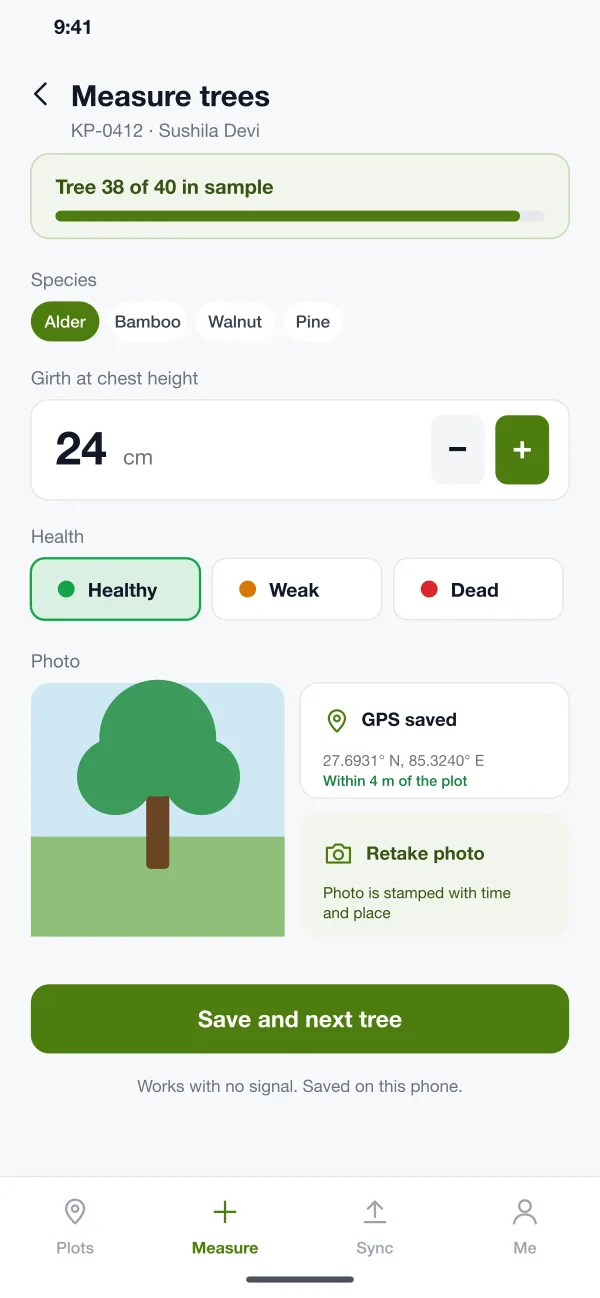
Measure a tree in four steps: species, girth, health and a photo -
Stop 2
Sync the day
Back in range, the surveyor taps Send. The office sees new trees, photos and places within minutes.
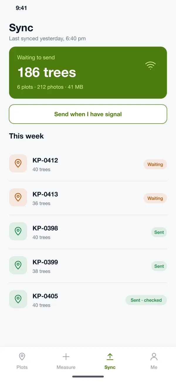
Sync screen: what is saved on the phone and what has gone to the office -
Stop 3
Spot a problem
The platform flags a plot where the live count is far below what the farmer planted, and sets it for a re-visit.
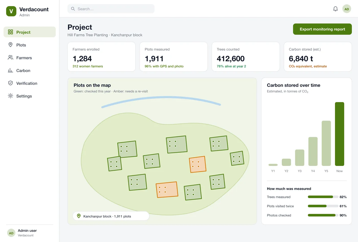
Project view: plots on the map, trees counted and carbon stored so far -
Stop 4
Hand over to the auditor
The team sends a pack for the year. The auditor picks a sample, checks it against photos and signs off.
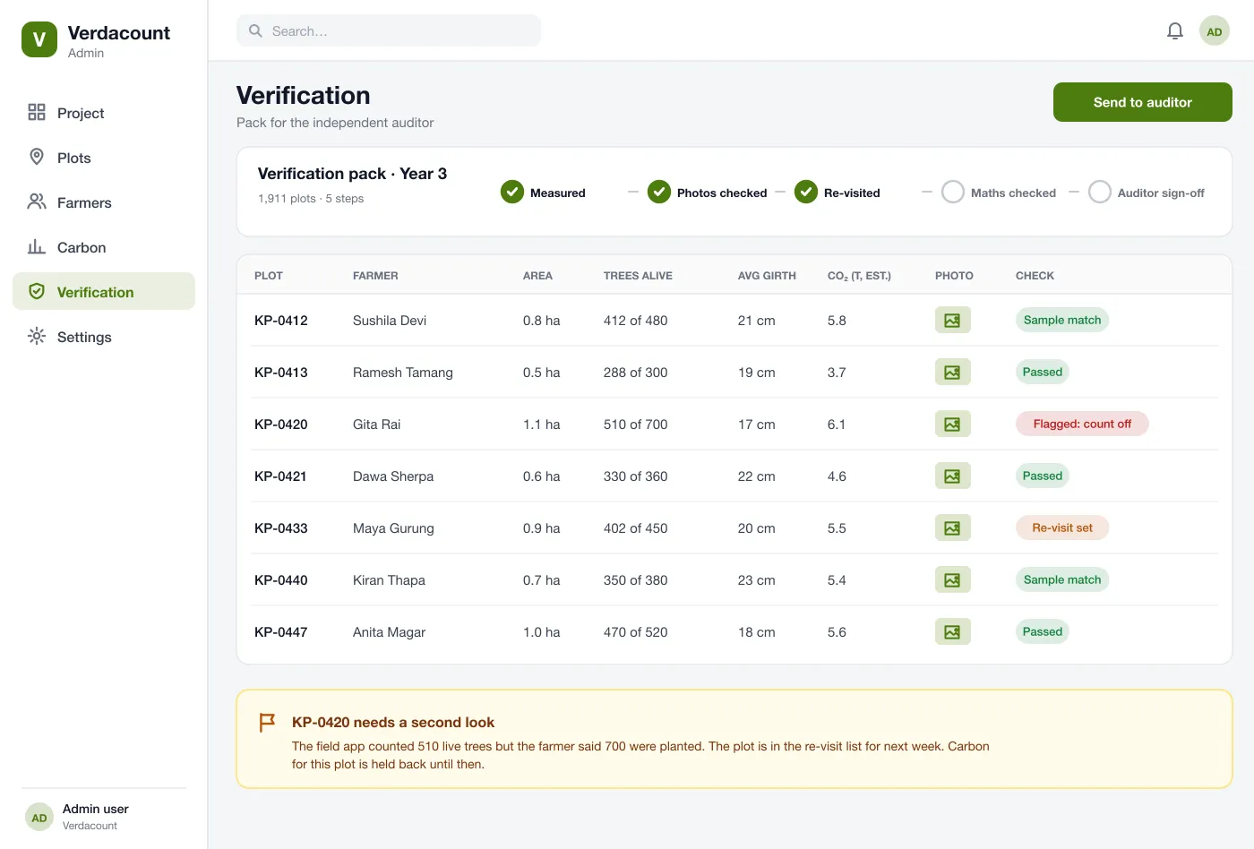
Verification: each plot’s numbers, photos and checks laid out for an auditor
Tools along the way
Built for the field
Big buttons, offline maps and a clear Sync screen, so a surveyor can work a full day far from signal.
Plot list and offline map
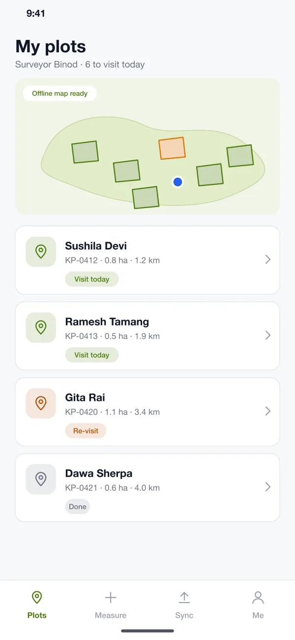
The field app shows the day’s plots with farmer name, size and distance. A map of the area is saved on the phone for use without signal.
Tree measuring
For each sample tree, the surveyor picks the species, sets the girth, marks health and takes a photo. The app stamps the photo with time and place.
Sync
The Sync screen shows what is waiting on the phone and what has reached the office, so nothing is left behind by mistake.
Clear for the office and the auditor
The project map, the carbon estimate and the verification pack read from the same tree records.
Project map and totals
The web platform shows plots on a map, trees counted, share alive and an estimate of carbon stored. Plots that need a re-visit show in amber.
Carbon estimate
The platform works out an estimate from measured trees with the formula you set. It shows the inputs, so the figure can be traced.
Verification pack
For the auditor, each plot shows its count, size, photo and checks. Odd counts are flagged, a sample can be chosen and the numbers for a plot can be held until it is re-visited.
Who uses Verdacount
Field surveyors
Open the day plots, measure sample trees and send the data when back in range.
Project team
See plots on a map, trees counted and plots that need a re-visit.
Auditors
Pick a sample, check it against photos and sign off the year pack.
Works without signalPlot and tree records stay on the phone until you send them.
Clear carbon estimateYou set the formula, and the inputs are shown beside the figure.
Auditor packEach plot shows its count, photo and checks, with odd counts flagged.
Common questions
What does MRV mean?
MRV stands for measure, report and verify. It means counting what a project has done, such as trees planted and kept alive, writing it down in a clear report and letting an independent person check it.
How long does it take to build a carbon MRV platform?
It depends on the measuring method your standard asks for, how many tree species and formulas you need, offline map needs and the reports your auditor wants. A first release with the field app, plot map and sync can come first.
Can you build a carbon measuring platform like this for my business?
Yes. We can build a field app for Android and iOS and a web platform for your project team, using the measuring method and formulas your standard or auditor requires.
Where do the carbon numbers in the screens come from?
The screens use sample figures to show where an estimate appears. A real project must use the formulas and tree data that its chosen standard asks for, and the platform runs whichever formula you set.
Does the field app work without internet?
Yes. In the design, plots, maps and forms are saved on the phone. Measurements and photos are stored there and sent when the surveyor has signal.
How does the platform help an auditor?
It puts each plot’s count, size, photo, place and time in one pack. The auditor can pick a sample of plots, see how each number was made and note what was re-visited.
See Verdacount in action
Walk through the field app, the project map and the verification pack.